


NAMPA — High pressure in the southern Idaho region makes Friday's forecast feel a little bit more like spring: light wind, mild temperatures reaching the upper 50s to low 60s, and sunshine!
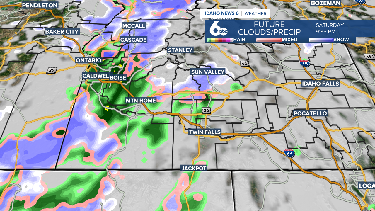
Enjoy it while it lasts, because on Saturday, a cold front heads to the area dropping temperatures. It'll be mostly cloudy in the Magic Valley and Treasure Valley during the day, and in the evening a weak system will bring precipitation to these areas.
Now let's get into the details of Saturday night's action. The system will head through Treasure Valley first, hitting Boise at around 6:00 PM with a 90% chance of precipitation. As temperatures drop on into the night, that rain will turn to snow...but it won't stick around. In the Magic Valley, expect the majority of the system to hit around 9:00 PM with a 70% chance of precipitation. There's also a slight possibility of thunder storms Saturday night.
For those of you ski/snowboard addicts, expect a few inches of fresh snow from 5,000 - 6,000 feet in elevation, particularly in the West Central and Boise Mountains. Sunday looks to be a good day on the mountains.
Early Sunday this system will clear out of the region heading east leaving behind sunshine and wind. For example, 20+ miles per hour wind in Twin Falls.
Sunday is also Spring Equinox, the sun will pass the equator heading north at about 9:30 AM Mountain Time.
Next week temperatures slowly rise with a northwest wind bringing warmer air. Temperatures will be quite balmy towards the end of the week even reaching the low 70s Thursday and Friday - about 10 degrees above normal.