NAMPA, Idaho — Boise had .40" of rain on Tuesday and the central mountains saw snow down to nearly 4,500 feet (ex. McCall, Stanley, Cascade, Donnelly, Bogus Basin).
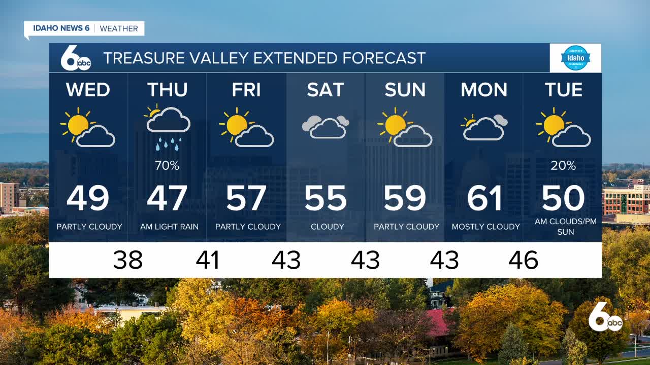
Showers have since ended but valley fog has formed in some areas with Boise looking clear as of 7 a.m but portions of the Snake Basin impacted. Despite anticipating dry, and partly cloudy conditions today, moisture continues to stream in from the Pacific in an eastward direction.
Another surge of precipitation is expected as early as 11 p.m tonight but with this notable valley rain and mountain snow comes a warm front making temperatures mild through Friday.
Snow levels are set at 3,500ft north to 5,000ft south and will rise to 6,500ft north and 9,000ft south by Thursday afternoon.


