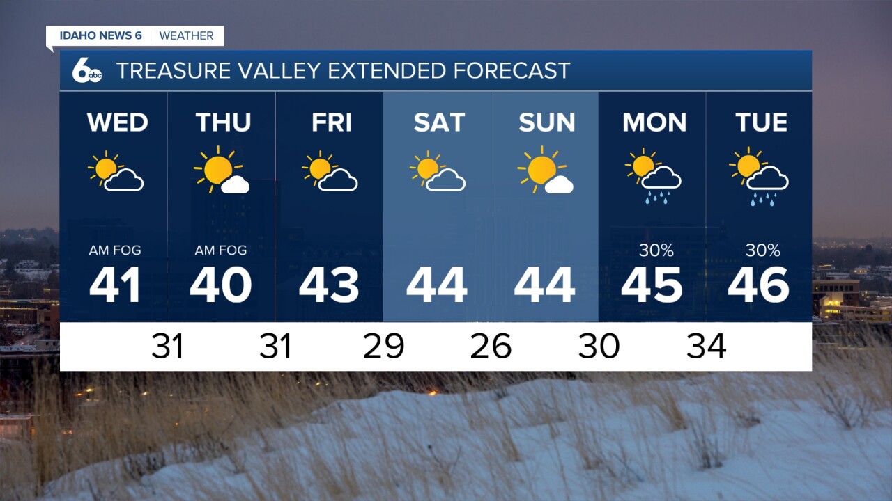
Temperatures are beginning to warm a bit in the higher elevations which is strengthening our inversion across Idaho. This means the colder air will settle into the valleys and we will continue to have low clouds and some patchy fog in the valley through at least Friday if not into the weekend. If the Treasure Valley had snow on the ground we would have much colder morning temperatures and more fog with less afternoon sunshine.

Seasonable temperatures are expected through Friday, with little day-to-day variation. As we head into the weekend, the inversion is likely to weaken, leading to more sunshine and warmer temperatures. Daytime highs will climb into the mid 40s then.


Computer forecast models are hinting at a storm system approaching Idaho on Tuesday. While valley temperatures will be too warm for snow, wintry weather is probable in the mountains. This disturbance may only drop 1"-4" in the central mountains.

A stronger storm is possible by the end of next week.
Stay connected right here or to my Facebook Page for more updates on our next chance of snow.