Thursday's weather is mild and breezy with some potential for brief, light showers to roll through the region....tonight though, is a different story.
Prepare for major wind, rain and snow that rapidly accumulates.
Widespread moisture on track to dominate the Pacific Northwest due to a atmospheric river that's pushing in from the coast. The system appears to blanket the entire state of Oregon this evening...and a lot of that action is headed here to Idaho overnight.
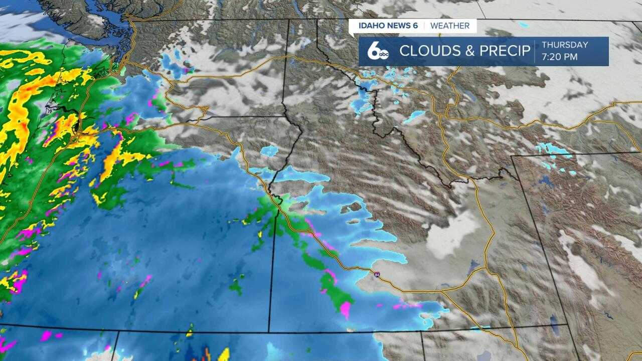
Around 5 PM, the system will push into SW Idaho ramping the chance of precipitation up to 100% in the Treasure Valley. Rain/snow will continue through the night and ease up Friday afternoon.
The central mountain areas most won't see this storm until 8/9PM. However, a Winter Storm Watch goes into effect at 5PM. We're looking at 6-12" of rapid snow accumulation - maybe more - by Friday morning. Wind gusts up to 50mph will be ripping into the region which means blowing snow will be a potential hazard on the roads.
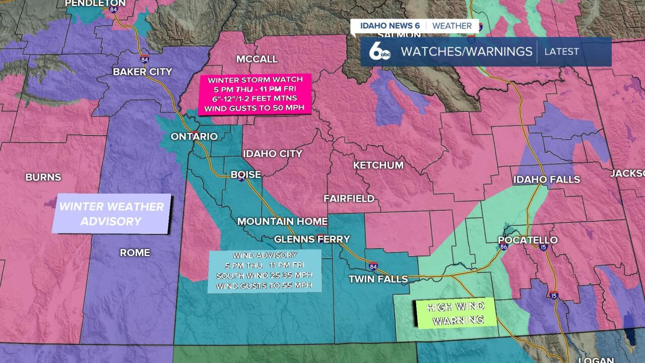
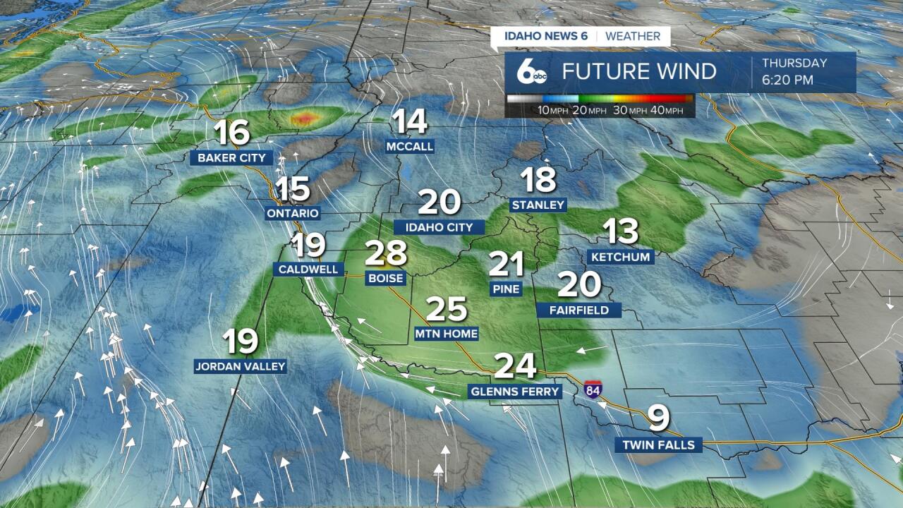
We will see intense southerly winds pick up this afternoon and evening with speeds from 25-35 mph. Gusts will be up to 50 mph. This wind carries through the night and into tomorrow. A Wind Advisory goes into effect at 5PM for areas surrounding the Treasure Valley, Magic Valley, and Owyhee County.
Here's an idea of what kind of wind you'll see around 6PM tonight.