

Boise hit 105 degrees making Sunday the hottest day of the year so far. The morning low temperature on Monday was 75 which was one degree away from a record warm morning!
Monsoon moisture and cooler air moving in from the west fired up thunderstorms as expected Monday morning across southwest Idaho. There were dozens of lightning strikes in the valley. If this situation occurs again later in the season when fuels are drier and the air is unstable, there could be even more serious fires started.

The lightning strike in the above image is likely the yellow strike on the map below directly under the word "Boise"

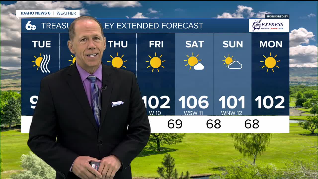
Enjoy these cooler temps if you can...because a heat wave is headed our way later this week. Temps will approach 100 again on Wednesday with 100+ heat likely through the weekend and beyond.

In the central mountains, we will have temps near 80 at 5000 feet (McCall) rising into the mid-80s to near 90 by Thursday.

Stay connected right here and on my Facebook Page for updates to my forecast heading into the coming weekend!