Forecast Update Mon 5:17pm: The latest computer information is hinting at bringing snow from the eastern part of the state further west now including places like Pine, Featherville, Sun Valley, Stanley, and even the northern Magic Valley. This is a concerning trend that I will continue to track over the next couple of days. There is the potential for snow Thursday night in the Magic Valley and as far west as Glenns Ferry. Please stay connected right here and to my Facebook Page for updates to my travel forecast.
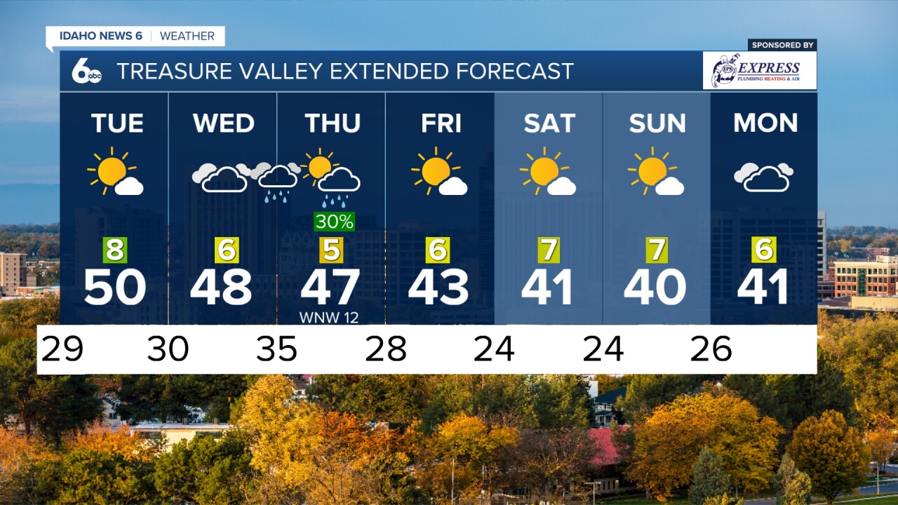
On Wednesday, a low-pressure system enters the Pacific Northwest, causing clouds to increase throughout the day and rain to likely arrive overnight. Snow levels will be around 4000-4500 feet, resulting in light accumulation and slick roads above 4500 feet.
By early Thursday morning, a low-pressure will form somewhere over central Idaho. New charts hint at the formation of that low pressure over the Pine, ID area as opposed to Arco, ID. This needs to be watched closely as it could have major ramifications to travel conditions Thursday night and Friday.

If you have holiday travel plans here is what you can expect. Keep in mind, that the best way to avoid snow covered roads is to travel during the daylight hours:
Wednesday: dry conditions across Idaho and points east while rain and some snow over the Blue Mountains with a slight chance of slick roads in the canyons. Rain with snow above 4000 feet across Idaho Wednesday night. Slick roads above 4000 feet are LIKELY at this time.

Thursday: Dry weather returns for Ada County west through the valley and all of Oregon. Snow could create issues even in the Magic Valley later on Thursday with slick valley roads POSSIBLE Thursday night. Slick roads are LIKELY on many eastern Idaho roads and definitely in the central and southeast mountains of Idaho, northern Utah, most of Wyoming, and western Montana. Idaho's west-central mountains will have some lingering snow showers but road conditions west of highway 21 are expected to be mostly dry. NO SNOW OVER THE BLUE MOUNTAINS IN OREGON.

Friday: Most areas will be dry and sunny except for the higher elevations of southeast Idaho and the interstates into northern Utah and Wyoming. NO SNOW OVER THE BLUE MOUNTAINS IN OREGON.