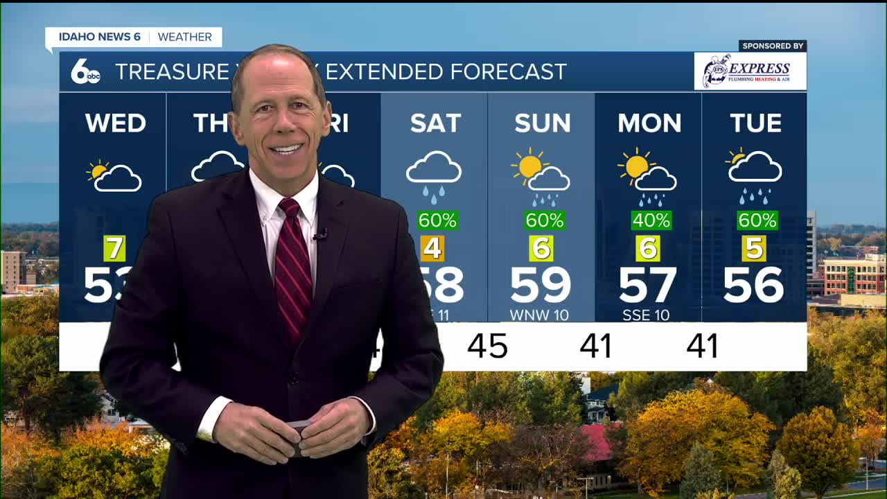


As we kick off November on Wednesday, seasonable temperatures continue with daytime highs in the mid 50s in the Treasure Valley and mid to upper 40s in the higher terrain. Overnight temperatures won't be as chilly for the remainder of the week, only dipping into the upper 30s and lower 40s. By the weekend, temperatures climb above normal topping out around 60° in the Treasure Valley and upper 40s and lower 50s across the higher terrain.

Clouds increase on Wednesday ahead of a series of disturbances coming from the Pacific. Precipitation breaks out Thursday afternoon as a warm front moves into the region. Much of the rain that falls in the valley with this storm will be Thursday evening and night. The warmer Pacific air will keep snow levels fairly high this time around at around 7000-8000 feet.

I am expecting any lingering rain to end as the sun comes up on Friday leaving a mostly dry day with clouds and a little sun along with temperatures near 60.
The next storm arrives on Saturday with a soaking rain likely into Saturday night. Rain totals of 0.25-0.75" for the Treasure and Magic valleys and upwards of 1" or more of rain for the central mountains.

Sunday may start out damp but has the potential to be drier in the afternoon with temperatures again near 60.


This weekend Daylight Saving Time comes to an end at 2:00 AM on Sunday, so make sure to set the clocks back an hour before heading off to bed on Saturday. Enjoy those later sunsets this week, on Sunday the sun will set around 5:30 PM!