


On Wednesday afternoon storms will form in central Idaho and move east to west into the West Central and Boise mountains. The Boise area will see gusty outflow winds from storms to the east. This gust front will blow through much of the valley during the evening. Winds could gust up to 45 mph Wednesday around 4pm. Blowing dust is quite likely in the valley at this time. Charts are showing some decent concentrations of lightning Wednesday late afternoon and evening across the Treasure Valley. This will increase the fire danger Wednesday evening.
There is also a Fire Weather Watch for southwest Idaho for Thursday afternoon through Friday 11pm for the possibility of lightning-caused fires.
July in Boise ended up 4.1 degrees above normal with eight 100+ degree days. The hottest temperature was 105 degrees on the 21st and 26th. The lowest high temperature was 88 degrees on July 4th. That was the only day below 90 in July.
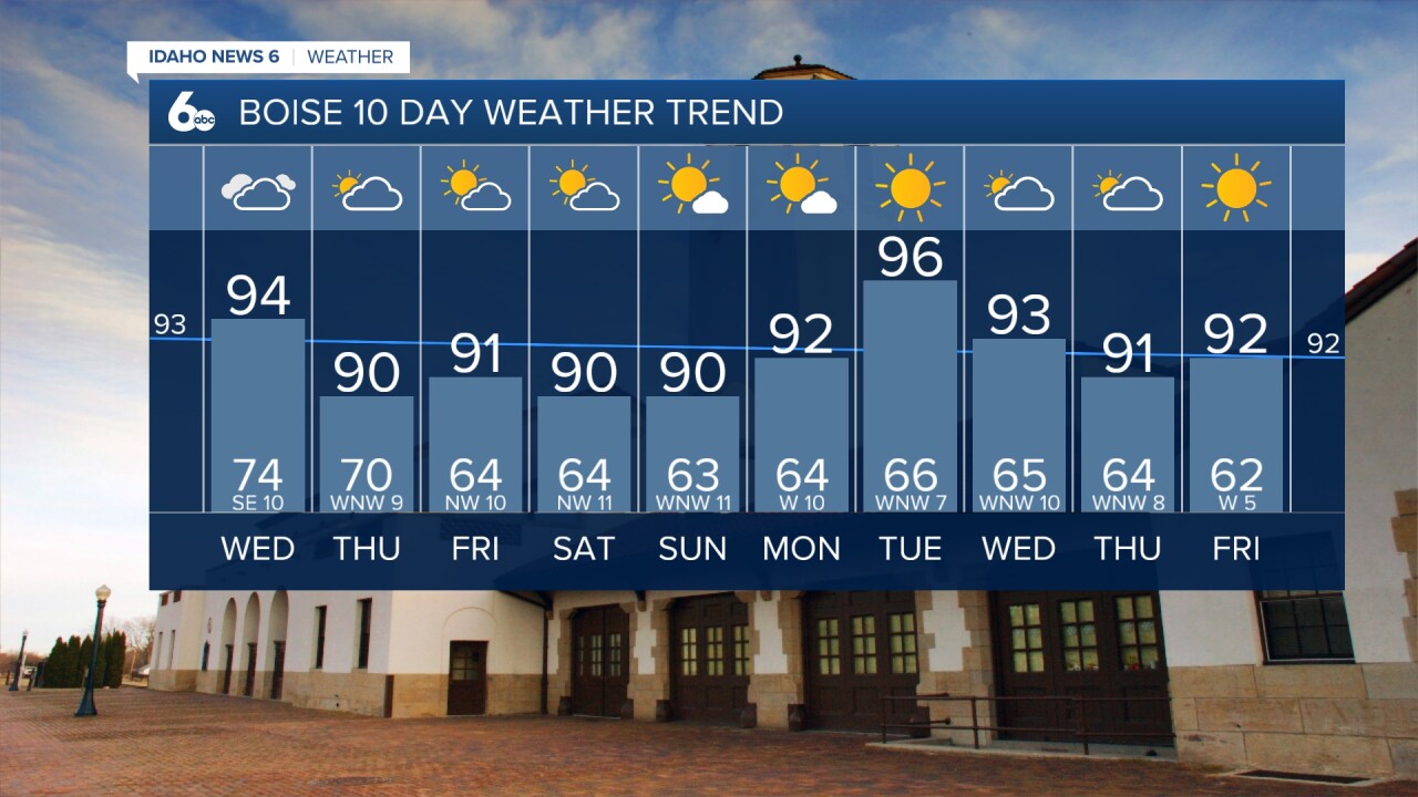
It will be close to a record warm morning on Wednesday with cloud cover keeping that morning low around 74 degrees which would tie the record set in 2004.

Thursday will be mostly cloudy and humid all day with a scattered afternoon storms developing especially in the higher terrain. Temperatures in the valley will be cooler at 90-93.
I believe the sun will return for Friday and the weekend in the valley with more comfortably hot afternoons temperatures running between 89-92. The central mountains have a chance of late-day storms on Friday and Sunday.

Stay connected right here for updates on my weekend forecast!