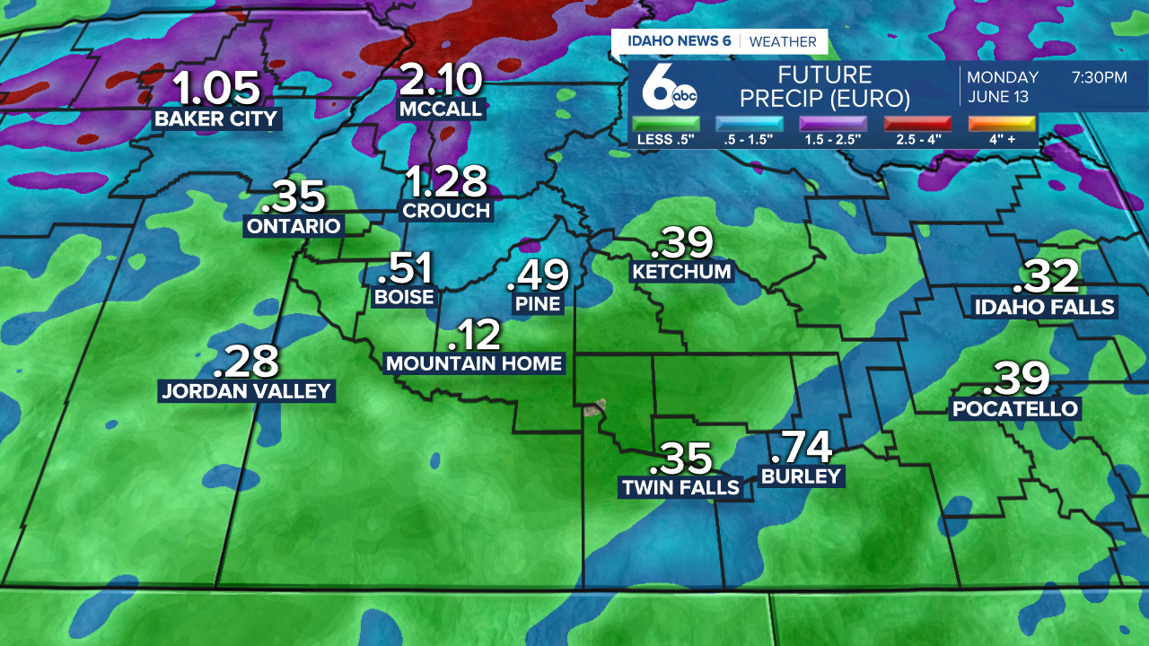
Heavy rainfall is in store for Idaho throughout the next few days as an atmospheric river from the Pacific travels over the region.
The system is moisture-heavy and is set to send rounds of precipitation through Idaho. It first hit northern Idaho today and will continue to move southeast as cold air pushes out warmer air over the next few days.
Central Idaho will start to encounter the impact of this intense system Saturday. The West Central Mountains will see a 90% chance of precipitation and thunderstorms with temperatures reaching the mid to upper 60s tomorrow. The East Central Mountains are tracking a 20% chance of precipitation at most.
A Flood Watch is in effect through Monday through large areas of northern and central Idaho, in addition to western Montana. If recreating in this area, be aware of the risk of flash flooding in creeks, streams, and rivers.
Choose Saturday if you want to get outdoors in southern Idaho - the atmospheric river will impact this region much more heavily on Sunday.
On Saturday in the Treasure Valley, temperatures will remain pretty warm reaching the mid-80s by the hottest part of the day. In the evening, there will be about a 20% chance of precipitation. Magic Valley will be drier and warmer with mostly sunny conditions.
Sunday, there is a 90% chance of precipitation in the Treasure Valley with scattered thunderstorms throughout the region due to atmospheric instability. That probability is about 65% in the Magic Valley.
These conditions will also be hitting central Idaho Sunday.
From Saturday to Sunday, heavy rain accumulations are expected.

This system is set to clear out by Tuesday.


