


More storms will develop on Thursday with locally heavy downpours possible especially in the mountains. Temperatures may hit the low to mid-90s but cool in the low 80s in any showers and storms. Mountain communities will see temps drop into the 60s and 70s in any storms.

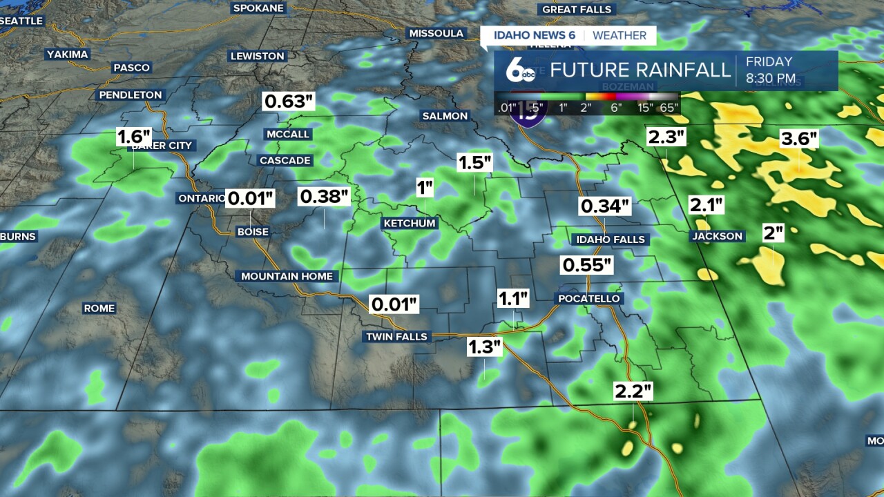
Some significant rain leading to potential flooding is likely from the Magic Valley into eastern Idaho. The map below shows potential rainfall through 8:30 pm Friday.

There is a chance of morning showers or a storm on Friday in the valley then becoming sunny with a high temperature in the low to mid-90s. By late in the day storms could develop over the valley. The central mountains could see scattered heavy downpours through the day along with cooler temperatures
On Saturday and Sunday I am expecting some nice weather with lots of sunshine and temperatures near 90 in the valley. While there is still a chance of a few afternoon showers in the mountains.

A RED FLAG WARNING is in effect for several counties in SW Idaho including areas of the Magic Valley due to potential fire starts from lightning.
Related: Most of Idaho is under Very High or Extreme Fire Risk

Keep checking back right here and to my Facebook Page for updates on our potential for storms!